Converting a 2D Mesh to a CAD Surface
By aquaveo on May 16, 2023Using CAD files can be a useful way to transfer project data between different modeling software that may not support all of the same file types. The Surface-water Modeling System (SMS) supports the conversion of terrain in the form of scatter surfaces and mesh surfaces to and from CAD data for easy transfer between systems that utilize CAD data.
To save a terrain from SMS as a CAD surface file:
- Deselect everything in the Project Explorer that doesn't contain the terrain data you want to work with. Depending on the amount of data currently in the Project Explorer, the simplest way to achieve this may be to right-click on an empty section of the Project Explorer and select "Uncheck All".
- Reselect the terrain data in the Project Explorer.
- Right-click in any empty space in the Project Explorer and select "Save as CAD". A save window will pop up and you'll be able to name the CAD surface file and choose where it will save outside of SMS.
The CAD surface data will then also appear in the Project Explorer. Once you assign a name to the file, you should be able to import it into your CAD software and make modifications. This file set will contain all the necessary surface data, including elevation, node, and element information.
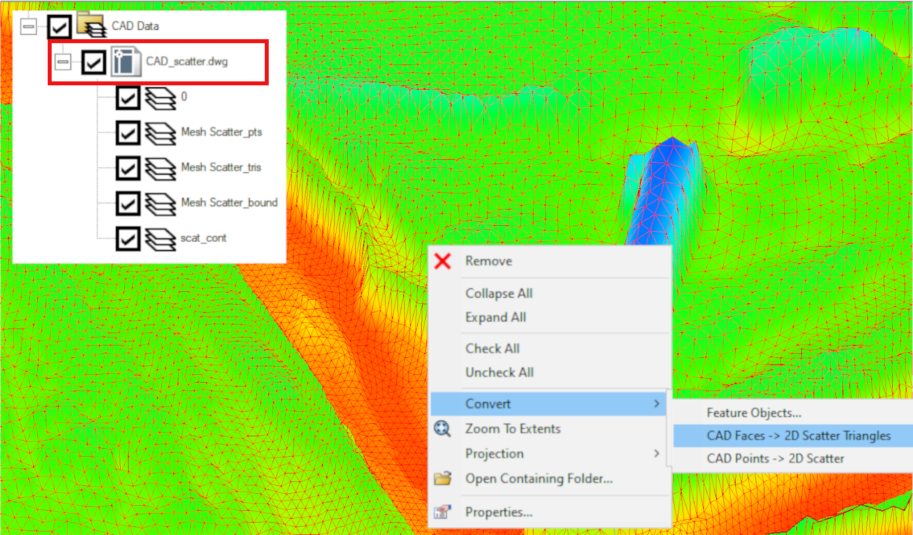
When importing CAD surface data into SMS, you'll need to convert it into a form that SMS can recognize so you can make changes and use the information stored in the file. To convert the data back into a form you can use within SMS, you just need to right-click on the CAD data under the CAD Data file folder in the project explorer. Then, select the "Convert → CAD Faces → 2D Scatter Triangles" command.
Head over to SMS and see how using CAD data can benefit your project today!
